Worst floods in a decade washing through the north
Robyn Wuth and Marty Silk |
Towns, cattle stations and airports are flooding along the Gulf of Carpentaria as the Queensland-Northern Territory border region faces its worst deluge in a decade.
The entire Gulf from the Top End to Cape York and southwards to central Queensland is due to be on flood watch overnight Thursday with rivers swollen from record rainfall.
Riversleigh near the NT border was battered with 278mm of rain and the New Century Mine copped a 220mm drenching in the 24 hours to 9am Thursday with meteorologists warning more water is the way.
The Barkley Hwy, the major sealed road linking the state and the NT, has already been cleaved along with hundreds of other roads across northwest Queensland.
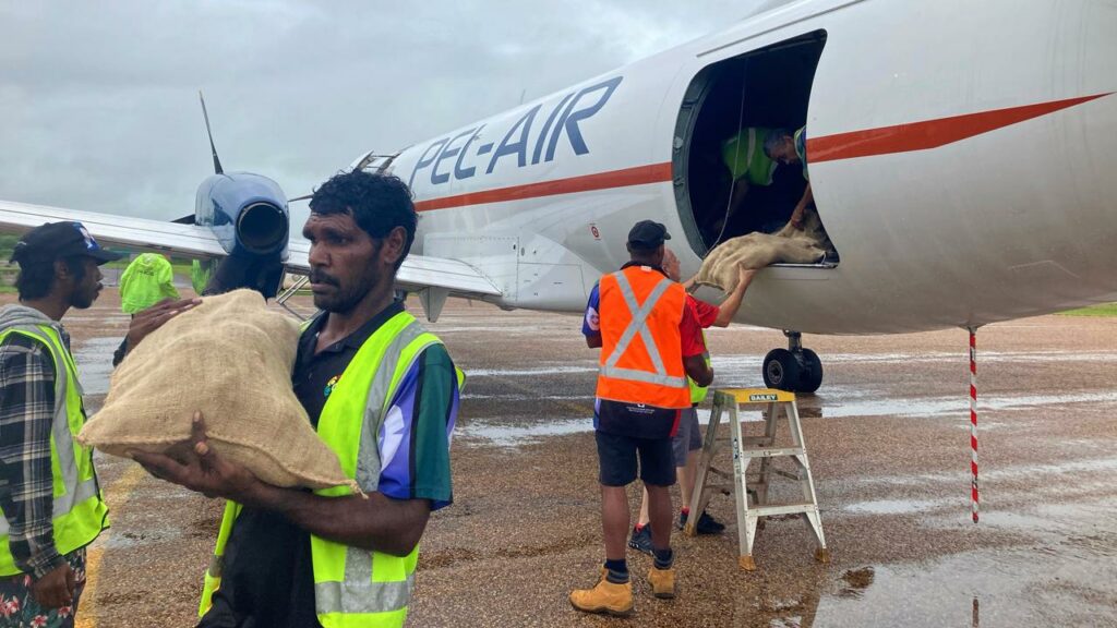
Dozens of people have evacuated homes at Doomadgee, Burketown, Normanton, Camooweal, Barkly, Gregory, Three Rivers and Lawn Hill with those towns cut off by floodwaters and relying on charter flights and barge shipments for food and essential supplies.
Queensland Fire and Emergency Service could not quantify the number of evacuations due to communication difficulties.
“The council has taken some people out, others have gone on mustering helicopters one or two at a time,” Burke Shire Mayor Ernie Camp told AAP.
“It’s a bit hard to know for sure, but we think at least 60 people have had to leave their properties.”
As cattle stations across the region went under water, ringers posted photos on social media of homesteads and outbuildings being lapped by waves and helicopter pilots posted videos of vast island seas.
“There’s nothing much they can do, the pilots are just watching the cattle drown,” Cr Camp said.
“The weak and young calves probably won’t make it, but hopefully most will have enough strength to survive.”
He said the floods are another devastating blow for a region “doing it tough” after COVID-19 and a devastating 2019 flood.
“This is the worst flooding I have seen in 60 years,” the mayor said
“The best thing people could do will be to wait for the floods to go down, the land to dry out and give us a chance to fix the roads and make a trip to the Gulf.
“Bring your fishing rod because it will be spectacular.”
A critical wastewater pump station at Burke has been inundated, with residents warned of potential exposure to raw sewerage.
Crocodiles have been spotted cruising in waters near the town.
“Please take care when you are moving around the community close to the floodwaters, and stay out of the water where possible to limit a chance encounter with a crocodile,” Parks and Wildlife ranger Zachariah Sowden said.
The Bureau of Meteorology is forecasting severe thunderstorms for parts of the already-flooded regions.
“Daily rainfall totals of 50mm to 100mm are likely, with isolated rainfall totals of 100mm to 200mm possible. Soils are saturated, meaning further rainfall will quickly impact river levels,” a BoM alert said.
The floods are threatening major regional centres including Mount Isa and Cloncurry.
“The (local disaster management group) has decided to make plans for a supply drop of food and medical supplies to Camooweal as a priority and is currently assessing the situation,” Mount Isa Council posted on Facebook.
“It is also making preparations for the possible evacuation to Mount Isa of people from low-lying areas beyond the … region in the coming days.”
AAP