Good ideas flow as Rockhampton looks to better manage flood risks
Richard Dinnen - Queensland Editor |
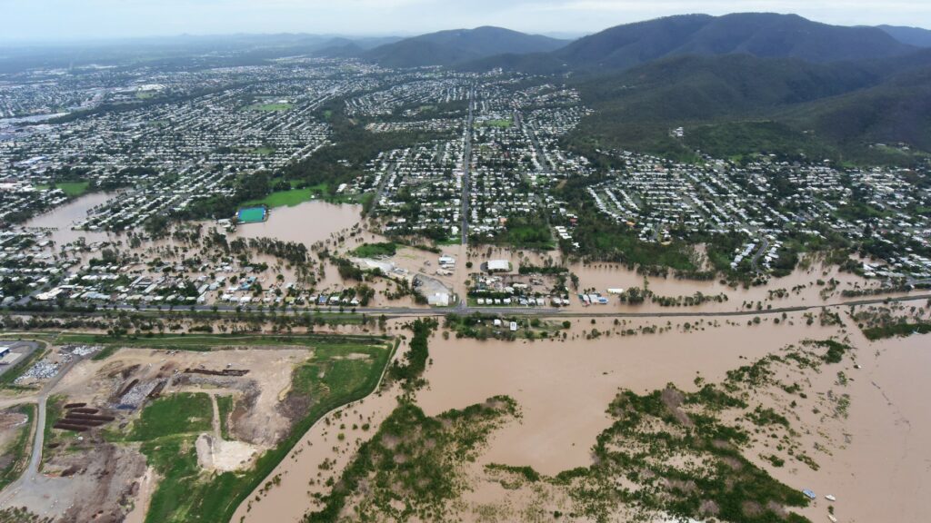
Rockhampton residents have flooded their local council with suggestions on how to manage flood risk in the region.
Rockhampton Regional Council held extensive public consultation over the past two months, as part of a project to amend its planning scheme in response to updated and new flood model and catchment studies.
Councillor Grant Mathers said hundreds of submissions had been received from property owners.
“During April and May, Council sent out over 6500 letters to property owners and tenants of over 2600 properties impacted by the flood mapping, so we did anticipate a large number of submissions.
“All submissions received by Council will be individually assessed by our team of engineers and a response will be provided.
“Once the review process has been completed, a final report will be presented to the State government for their recommendation. We will keep the community informed of the progress.”
The Council recently completed updated flood studies for the North Rockhampton Creek catchments, while new flood studies and assessments were done for previously unmodelled catchments in south and west Rockhampton, Wandal, Gracemere North, and Mount Morgan.
The studies led to new and updated flood hazard mapping for those areas.
Flooding is a regular event in the Rockhampton region, with the Fitzroy River breaking its banks many times since records began in 1859.
The highest recorded flood in Rockhampton was in 1918 at 10.11 metres.
Flood mitigation projects for Rockhampton were submitted to the former Federal Government for financial support from its six-billion-dollar Emergency Response Fund, but they did not secure funding.