Hurricane Erin forecast to churn up dangerous swells
ALLEN G. BREED and JOHN SEEWER |
Hurricane Erin is churning slowly toward the eastern US coast, stirring up treacherous waves that already have led to dozens of water rescues and shut down beaches in the midst of summer’s last hurrah.
While forecasters remain confident the centre of the monster storm will remain far offshore, the outer edges are likely to bring damaging tropical-force winds, large swells and life-threatening rip currents into Friday.
Warnings about rip currents have been posted from Florida to the New England coast with New York City closing its beaches on Wednesday and Thursday. Several Long Island and New Jersey beaches also will be off-limits.
“Enjoy the shore, enjoy this beautiful weather but stay out of the water,” New Jersey Governor Phil Murphy said on Tuesday.
Off Massachusetts, Nantucket Island could see waves of more than three metres later this week.
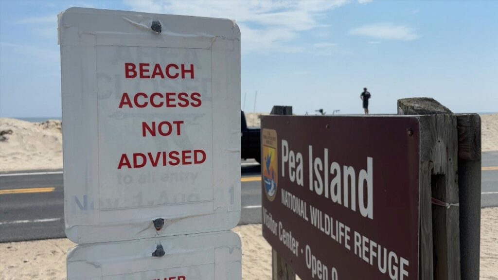
But the biggest threat is along the barrier islands of North Carolina’s Outer Banks where evacuations have been ordered.
Erin has become an unusually large and deceptively worrisome storm while moving through the Caribbean, with its tropical storm winds stretching 370km from its core. Forecasters expect it will grow larger in size as it moves through the Atlantic and curls north.
It continued to lash the Turks and Caicos Islands on Tuesday, where government services were suspended a day earlier and residents were ordered to stay home, along with parts of the Bahamas before its expected turn toward Bermuda and the US.
By Tuesday, Erin had lost some strength from previous days and dropped to a Category 2 hurricane with maximum sustained winds of 170km/h, the National Hurricane Center in Miami said. It was about 915km south-southeast of North Carolina’s Cape Hatteras.
Tropical storm watches were issued for Virginia and North Carolina as well as Bermuda.
Rough ocean conditions already have been seen along the US coast — at least 60 swimmers were rescued from rip currents Monday at Wrightsville Beach, near Wilmington, North Carolina.
The biggest swells along the East Coast are expected over the coming two days.
Climate scientists say Atlantic hurricanes are now much more likely to rapidly intensify into powerful and catastrophic storms fuelled by warmer oceans.
On the Outer Banks, Erin’s storm surge could swamp roads with waves of 4.6 metres.

North Carolina Governor Josh Stein warned residents along the coast to be prepared in case they need to evacuate and declared a state of emergency.
The Outer Banks’ thin stretch of low-lying barrier islands that jut into the Atlantic are increasingly vulnerable to storm surges.
There are concerns that parts of the main highway could be washed out, leaving some routes impassible for days.
AP