Residents hunker down as cyclone heads for coast
John Kidman, Abe Maddison and Poppy Johnston |
Residents in Queensland’s far north are readying for tropical Cyclone Koji that is threatening to hit the coast as a category two system.
Heavy rain and destructive winds are expected when the storm crosses south of Townsville on Sunday morning.
The storm was upgraded from a tropical low by the Bureau of Meteorology on Saturday evening, and threatens wind gusts up to 130km/h between Townsville and Proserpine.
Authorities warned that conditions would be dangerous as the system approached, with gale-strength winds likely from late afternoon.
Its force will be enough to knock down trees and powerlines, and blow away anything not tied down outside, according to the emergency warning.
“This is a risk to life. Heavy rain may cause flooding in some places,” the warning says.
“Power, phones, internet and water might stop working. Roads could be blocked by fallen trees, powerlines or flood water.”
Warnings are in place for much of the northeast Queensland coast from Innisfail to Mackay, including Townsville, Palm Island, Bowen, Proserpine and Whitsunday Islands.
Premier David Crisafulli was adamant earlier on Saturday that the already hard-hit region was “better prepared than ever” to handle the challenge.
The tropical low was at that stage stationed east of Cooktown, with a 50 to 60 per cent chance of developing into a category one cyclone.
Koji is expected to deliver strong wind gusts, heavy downpours in already-soaked catchment areas and a risk of flash floods.
“Rainfall will ramp up later today and into tomorrow through firstly the Central Coast region and then into the Herbert and lower Burdekin,” Bureau of Meteorology forecaster Dean Narramore said.
“There are severe weather warnings from Port Douglas down to Mackay and cyclone warnings are also current from Port Douglas into the Ayr area.”
Despite the concern, Mr Crisafulli said swift-water rescue craft, police, SES officers and paramedics were in position and would work with residents on the ground.
“The locals know their patch and the challenges,” he said.

From Sunday, the focus will likely shift south, with the storm gradually moving inland from central Queensland.
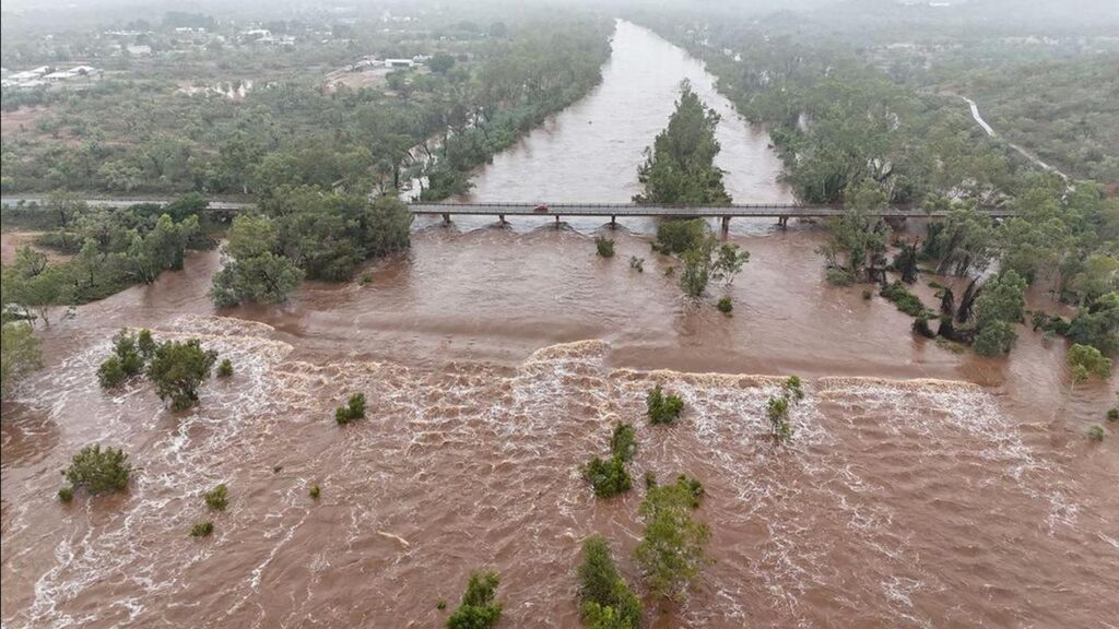
In the northwest, major flooding that has already heavily affected Gulf Country communities – where livestock losses are projected to be significant – continues on the Flinders River.
Major flood warnings have also been issued for the Herbert, Haughton and Tully rivers.
AAP