‘You are in danger’: hundreds call for help amid storms
Nick Wilson, William Ton, Robyn Wuth and Allanah Sciberras |
Millions are being warned not to celebrate too soon after life-threatening flash flooding and dangerous thunderstorms passed over a major city.
Dangerous thunderstorms swept across Melbourne on Tuesday afternoon, bringing rapid floods and power outages to thousands of homes.
Severe thunderstorm warnings were issued for the northern, eastern and southern suburbs, with some residents warned to remain indoors.
Thousands of households across the city were left without power, while rivers including the Werribee, Yarra and Bunyip overflowed.
While the worst of the storms have passed over the city, showers and storms are expected to return throughout the evening.
Victoria’s State Emergency Service received nearly 230 requests for assistance across the day, with 56 still active on Tuesday evening, a spokesperson told AAP.
More than half related to building damage or fallen trees, while 70 resulted from floods.
An emergency warning was put in place for Seymour, Castlemaine, Kyneton, Kilmore and surrounds shortly after 7.30pm AEDT, with residents urged to remain indoors as intense rainfall, damaging winds and life-threatening floods lashed the region.
“These thunderstorms are very dangerous,” Vic Emergency said.

A separate severe thunderstorm warning was implemented for the state’s Central, East Gippsland, Mallee, Northern Country, North Central and North East regions shortly after 6pm.
The bureau warned residents in the firing line to expect intense rainfall, damaging winds and large hailstones, as a humid mass of air combined with a slow-moving trough to bring unpredictable storm conditions.
Nearly 27mm of rain was recorded at Kyabram, about 200km north of Melbourne, in the 30 minutes leading to 6.45pm.
It followed an earlier warning to people in areas including Glen Waverley, Ringwood, Mill Park, Bundoora, Dandenong, Belgrave, Berwick and the area east and south of Pakenham towards Koo Wee Rup and Poowong to move indoors immediately.
A flood watch was in place for central and eastern Victoria on Tuesday afternoon, including river catchments in the Melbourne area.
A warning was issued for towns within fire-affected grounds, with authorities warning burnt land does not absorb water effectively, meaning runoff can occur quickly and without warning.
“We’ve got some concerns, particularly around the fire grounds with increased fast runoff and flash-flooding risks,” Mr Gamble said.

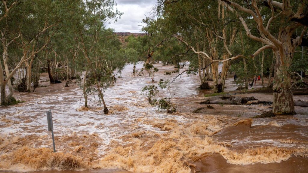
The drenching in the south comes as Australia’s parched interior braced for wild weather from a storm band lingering over the nation’s usually dry, red heart.
Rail services have been affected, roads are cut off and freight deliveries stranded as hundreds of millimetres of rain inundate multiple states.
A slow-moving tropical low is causing havoc across central Australia, with heavy falls and damaging winds reported across the Northern Territory.
Some of the heaviest falls from Monday through to early Tuesday were in the NT, with 79mm at the Granites in the Tanami Desert.
AAP