Millions brace for ‘cyclogenesis’ impact on east coast
Farid Farid and Sam McKeith |
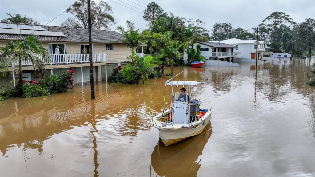
Parts of Australia’s east coast devastated by deadly floods are being warned to brace for more inundation when a “cyclogenesis” makes peak impact.
Almost 400 State Emergency Service personnel, helicopters and high clearance vehicles are on stand-by as a coastal low pressure system intensifies off the north coast of NSW.
The Bureau of Meteorology forecast the “deepening” severe system to become more defined on Tuesday, bringing with it heavy rain, strong winds and hazardous surf conditions.
Peak impact would be on Wednesday, from Coffs Harbour south to Bega and includes a flash-flooding risk at Wallis Lake near Taree, one of the towns hard hit by floods in May that killed five people and damaged thousands of properties.
Bureau meteorologist Angus Hines said the system met the definition of a “cyclogenesis”, the formation of a low pressure area, forecast to become a “vigorous” coastal low from Monday night.
NSW SES Deputy Commissioner Debbie Platz said short periods of significant rainfall were expected in the developing low, which authorities had been monitoring since last week.
“This is a very dynamic and fast-moving system,” Ms Platz told reporters at SES headquarters in Wollongong.
“It’s likely that this system will bring significant weather to these coastal fringe areas.
“We do expect that as a result of that we will have flash flooding, as opposed to riverine flooding, that is not to discount riverine flooding.”

While flash flooding was most likely, it did not “mean that we won’t have some rises in some of our river systems that have already been impacted over many months”, Ms Platz warned.
Bureau hazard preparedness manager Steve Bernasconi said the system would be most intense on Wednesday, bringing damaging winds and coastal erosion to large stretches of coast.
The damaging winds were expected in Sydney, the Hunter Valley and Illawarra regions.
There was also hazardous surf expected along the coast, the bureau cautioned.
The heaviest rain was expected over the state’s central coast, with totals of up to 200mm possible, although a “subtle shift” in conditions could move those falls to Sydney or the mid-north coast.
“As we move into Thursday, rain will ease, the winds and the surf may still remain a hazard, and on Friday conditions are expected to improve,” Mr Bernasconi said.
On the mid-north coast, dairy farmer Michael Jeffery said the forecast brought back memories of May’s catastrophic natural disaster.
“It’s been raining all day already and that’s really got everybody on edge,” Mr Jeffery said from the banks of the Macleay River, near Kempsey.
“It causes a lot of concern, because your livelihood is at risk, all the infrastructure on your farm that’s already been damaged by a flood and you worry about all your cattle and their wellbeing.”

Mr Jeffery, chairman of the dairy co-operative Norco, said the May floods cost him more than $1 million and prompted him to sell more than 100 milking cows.
He attended a rally on Sunday, when hundreds in Kempsey protested over a slow rollout to primary producers of state and federal government disaster aid.
“Some farmers are basically at the end of their tether, and they’ve got to make decisions, whether they try and stay farming, or whether they they should get out,” Mr Jeffery said.
Premier Chris Minns has defended the rollout, saying necessary paperwork from the state government has been submitted to expedite the process.
AAP