Top Enders thanked for heeding cyclone advice
Lloyd Jones |
Top End residents have been thanked for following advice to hunker down and ride out tree-felling cyclone Fina’s damaging winds and driving rain.
After hours of enduring the storm’s howling fury overnight, residents of Darwin and surrounds have emerged to learn no one has been reported seriously injured and property damage is less than expected.
Darwin’s trees did not fare so well, with dozens felled across the city and in surrounding regions.

On Sunday Northern Territory Chief Minister Lia Finocchiaro and NT Police Commissioner Martin Dole praised residents for following emergency authorities’ instructions.
“I just want to thank Territorians for how well they have co-operated and heeded all of the advice from our officials,” Ms Finocchiaro told reporters.
Mr Dole echoed the sentiment, saying Territorians’ responsiveness had led to no reports of serious injuries and no significant damage across the Darwin region.
Around 19,000 homes and businesses lost power during the storm and work crews have been busy trying to restore it.
Ms Finocchiaro said school principals had been asked to assess whether their schools were ready to resume business as usual on Monday.
With top gusts of 195km/h and sustained winds near the centre of the system of 140km/h, Fina tore down trees and cut power in many places.
In Darwin gusts reached 107km/h and many large trees were blown down.
The city had 157mm of rain since 9am on Saturday, recorded at the airport, while Middle Point to the southwest of Darwin copped a massive 393mm.
The storm is the strongest cyclone to approach Darwin since Tracy flattened the capital in 1974, killing 66 people.
Category-three Fina brought destructive winds and heavy downpours to remote Tiwi Islands communities, then the capital and nearby regions on Saturday and into Sunday.
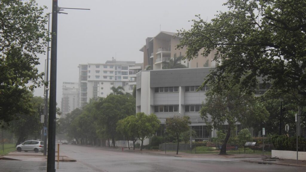
It was a noisy and in many cases sleepless night for Darwin residents as high winds rattled, banged and shook everything in their path.
The sweeping sheets of rain on the streets and high wind gusts kept people indoors.
Emergency shelters were open in Darwin, nearby Palmerston and adjacent rural areas, with people urged to bring their own bedding and food.
Part of a ceiling at the Royal Darwin Hospital collapsed on Saturday but no one was hurt, Emma Carter of NT Police told ABC Radio Darwin.
On Sunday Fina was tracking away from Darwin offshore to the west, where it has intensified into a category four system but is expected to peter out next week off the Kimberley coast.

Dean Narramore, Senior Meteorologist with the bureau, said in inland areas heavy rain could still isolate homesteads and communities, flood roads and possibly inundate businesses if the deluge continued throughout Sunday.
Prime Minister Anthony Albanese said on Sunday the Commonwealth was providing “every bit of support requested” and his thoughts were with Northern Territorians.
At the Darwin waterfront on Sunday morning, local resident Alastair Shields told AAP his home lost power on Saturday night and a nearby road was blocked by a fallen tree.

“It was a bit of a rough night, windy and noisy,” he said.
“You couldn’t see what was happening but you could hear trees cracking and falling. That was pretty hair raising.
“It was a wild night, the clean-up begins.”
AAP